Overview
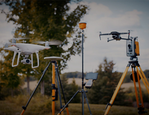
The scientific method of determining positions of points on the surface of earth, measuring distances , elevations, angles, directions between them is called as surveying and mapping. The purpose of this activity is to create maps and layouts of the land. This data becomes essential for planning and designing all kinds of civil projects like building roads, highways, bridges, commercial and domestic structures. In short, creating accurate maps with descriptions and specifications as required by the objective of the survey. It is carried out by qualified and licensed surveyors. There are various tools that assist in creating survey reports and maps. Some of the most popular tools are theodolites, measuring tapes, total stations, 3D scanners, GPS/GNSS and Level and rod. Areial surveys are done at times when the land is vast and would require humungous manpower and considerable time to complete the activity.
Challenges
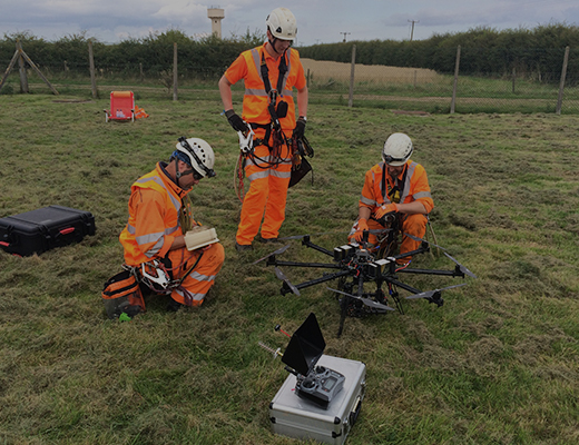
Manpower needed to survey vast lands is quite a challenge. Even if this is overcome, the time taken to painstakingly cover the targeted area goes to months. Couple this with harsh weather conditions like windy, rainy days. Clear line of sight is also another huge problem that surveyors face. There is nothing like an ideal condition where there are no shadows, or any obstacle in the line of sight for surveyors. All in all, this also affects the data captured and calculated. Precious time lost, accuracy of data gets compromised are some of the perils of manual surveying and mapping.
Drones – The Only Answer
Drones on the other hand, is something a single person can carry to difficult terrains, assemble and deploy in minutes. The flexibility that drones offer is none compared to the traditional surveying techniques. Fast, reliable , drones bring down the time taken for surveying and mapping considerably. Accuracy of data, capturing data on difficult terrains is the other huge advantage of using drones in surveying and mapping.
Why UAV Concepts?
UAV Concepts with its huge network of offices in the country, the tie ups with best of drone manufacturers, experience of handling customer requirements of over 3 decades is completely able to service the needs and requirements of customers across the country.